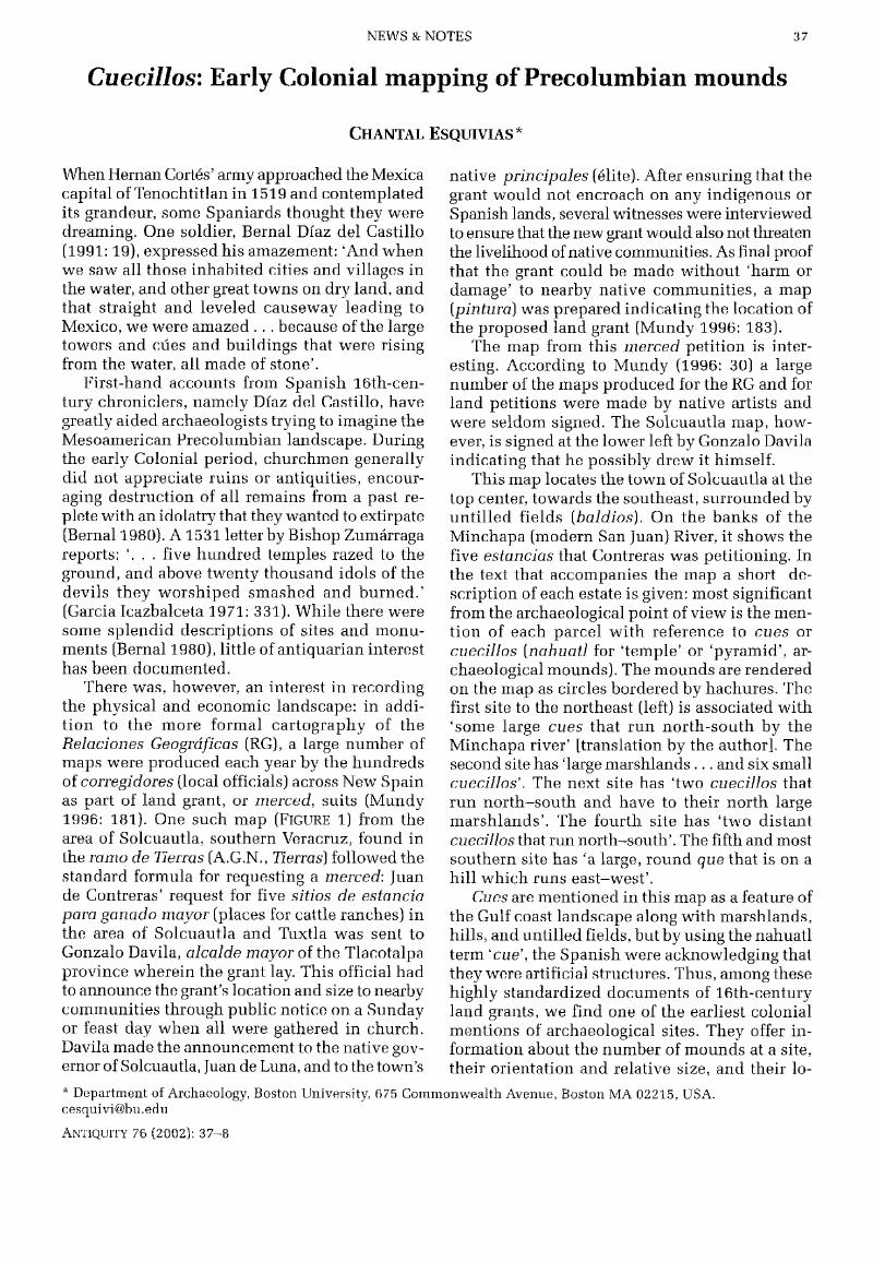
Hostname: page-component-76fb5796d-qxdb6 Total loading time: 0 Render date: 2024-04-26T03:26:08.886Z Has data issue: false hasContentIssue false

Cuecillos: Early Colonial mapping of Precolumbian mounds

Published online by Cambridge University Press:  02 January 2015

Chantal Esquivias*
Affiliation:
Department of Archaeology, Boston University, 675 Commonwealth Avenue, Boston MA 02215, USA. cesquivi@bu.edu

Abstract

Image of the first page of this content. For PDF version, please use the ‘Save PDF’ preceeding this image.'
Type
News & Notes
Copyright
Copyright © Antiquity Publications Ltd. 2002

Access options

Get access to the full version of this content by using one of the access options below. (Log in options will check for institutional or personal access. Content may require purchase if you do not have access.)

References

Archivo General de la Nación (A.G.N.), Mexico City. Tierras, 1588–89, vol. 2735–2a. parte, exp. 15, fs. 1–10 (map).Google Scholar
Bernal, I. 1980. A History of Mexican archaeology, The vanished civilizations of Middle America. London: Thames & Hudson.Google Scholar
Díaz del Castillo, B. 1991. Historio Verdadera de la Conquista de la Nueva España. Mexico D.F.: Alianza Editorial.Google Scholar
García Icazbalceta, J. 1971. Don Fray Juan de Zumarraga, in Colección de Documentos para la Historia de México. Mexico: Editorial Porrua.Google Scholar
Mundy, B. E. 1996. The mapping of New Spain, indigenous cartography and the maps of the Relaciones Geográficas. Chicago (IL): University of Chicago Press.Google Scholar